How to Build a Simple Magnetometer for finding Gold

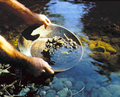
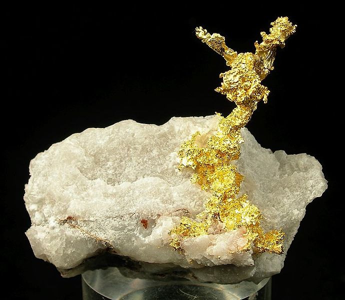
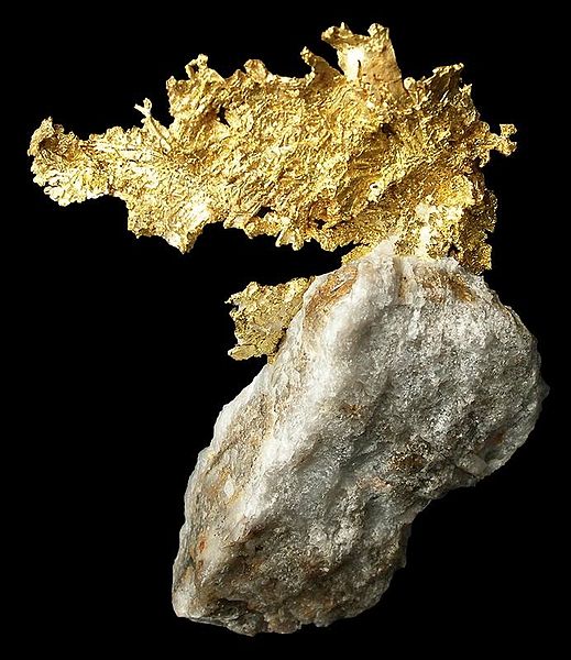
The earth is nothing more then a giant magnet as attested by its magnetic poles that attract a magnetic needle to magnetic North and South. The same phenomenon of magnetic attraction can be used to detect magnetic minerals even as small as what are termed micro-mounts, or for that matter large masses of magnetic mineral like magnetite below the surface of the earth. Although gold itself is not magnetic that often occurs in the company of different minerals that are; one example is granular magnetite.

This deceptively simple magnetometer can be used both at home or in the field. Its materials are also simple consisting of a very few parts that are obtainable anywhere. The core of this magnetometer is nothing more complicated than an ordinary soda straw with a small magnet glued on one end. There is a needle shoved through the straw at approximately its balance point with the magnet attached. The needle rests on two parallel sides are far enough apart to allow the straw to present up and down.

The best kind of magnet that you can use as a so-called rare earth magnet that is far more powerful than an ordinary magnet. Small maintenance of this type can be found in auto parts stores, sources say are part of an automobile alternator they can also be found in your local junkyard. The best kind of soda straw to use is one that has a flexible joint near its upper end, so you can bend the straw to get it perfectly balanced.

At home your magnetometer is used to detect magnetic minerals that is accomplished by passing the near the magnetic tip to see if the magnet is attracted. If it is you know immediately whether or not the mineral is magnetic, conversely if the magnet is not attracted to the specimen then it is not magnetic. This is important because many minerals look alike and the magnetometer test is one step in identifying the mineral.

In the field; all you have to do is walk a straight line while watching the straw, if the magnet is attracted to a magnetic mass in the ground the straw will move up or down. This is also important because many different mineral deposits are magnetic and have other minerals that are associated with them including gold. A simple method of measuring the amount of dip is by placing a quadrant next to the straw allowing you to measure the amount of dip the straw undergoes.

A simple magnetometer of the type described can be seen by following this URL:


Equipment Needed for Gold Panning

How to use a gold pan is something that is easily learned, but requires some practice.  The gold pan as we know it was invented by some Yankee tin-knocker during the California gold rush of 1849. Prior to that just about any water-tight container was used; one of the most common was a shallow wooden box.  The author has even used a plastic food container as a gold pan in a pinch.

A gold pan in use.
As illustrated by the assortment of gold pans and gold pan sets illustrated in the Amazon search box at the bottom of this Blog it is possible to purchase many different varieties and configurations of gold pans. We personally prefer using a whole set consisting of a 14 inch classifier that is used to remove anything larger than 3/8 of an inch. What passes through the classifier goes into a 14 inch green plastic pan. This larger pan is used to work down the bulk of the gold bearing gravel. What is left in the pan is to concentrate consisting of mostly black sand and other stream heavies including gold. Although you can work down through the sand to its gold content it is more efficient to save the sand for later.   

A gold panning kit also includes a couple of other handy items; one of them is a small squeezable plastic bottle equipped with a plastic tube that is used to suck up small pieces of gold and gold dust in your pan. The other handy thing is a couple of small plastic vials that are used to keep the gold in you collect. Gold is placed into the vials from the suction bottle simply by squeezing it causing the gold to be expelled.


The other equipment that is required on a successful gold panning expedition is not directly related to gold panning, but they are things that you actually need. You will need a jeweler's loup with a 10 X. magnification, a long handled shovel and if the water is cold a pair of waterproof gloves. Since you are apt to be wandering around in the bit of a stream or other place with standing water it is a good idea to have a pair of rubber boots.

This is the basic equipment required for a successful gold panning expedition!


Gold Occurrences in Maine

This article explains some of the gold occurrences found in Maine where gold can be had from three different sources as placer gold, lode gold where it occurs in quartz veins and as a trace element associated with metal sulfides especially pyrite where it occurs in thin films between individual pyrite crystals.

According to the Maine Geological Survey placer gold has been found in the following streams:

Sream
Township
County
Swift River and its tributaries
Byron area
Oxford, Franklin
Sandy River
Madrid to New Sharon
Franklin
South Branch-Penobscot River
Sandy Bay; Bald Mtn; Prentiss
Somerset
Gold Brook
Bowman
Oxford
Gold Brook
Chain of Ponds; Kibby
Franklin
Gold Brook
Chase Stream
Somerset
Gold Brook
T5 R6; Appleton Township
Somerset
Nile Brook
Dallas; Rangeley
Franklin
Kibby Stream
Kibby
Franklin
St. Croix River
Baileyville
Washington

This is the kind of mountain stream where you can expect to find gold.
This list is by no means conclusive because virtually any other stream in the vicinity of those listed can also contain gold. The bed load of the streams eventually reaches the Atlantic Ocean where the litterol current carries in parallel to the coastline depositing its load of gold onto the sand and gravel beaches of Maine. As a teenager the author did some prospecting along these beaches discovering that the gold that was present was mainly flowered gold. The most gold was discovered near the mouths of the rivers running into the ocean. 

Ogunquit Beach, Maine where as a teenager we panned for gold.  Notice the small stream entering the ocean on the left side of the picture it was here where we had our most luck panning.

Because gold is 19 times denser than water another place that might be profitable to look is in the lower reaches of sand and gravel deposits where the deep deposits are at rest on bedrock or a bed of clay. Another factor that has to be taken into consideration is stream migration. Since the time of the glacier melting around 12,000 years ago the stream channel may have migrated several hundred feet to the West of its original position. To the practiced eye this can be readily seen by an area of flat terrain with the higher banks on the west side of the stream.  This is a situation that not only exists in Maine, but is a worldwide phenomenon where ever you have flowing water.

Gold on Quartz   Photo by Rob Lavinsky

Placer gold is that the only variety of gold found in the state of Maine.  Maine also has lode gold where gold is found in quartz veins. Even more complicated is gold deposits found as trace elements in base metal sulfides where gold is found as an impurity that must be recovered when the metal ore is smelted.  Finally gold is often associated with iron pyrite where it is a thin film between the crystal faces of pyrite.

You can purchase all kinds of supplies and equipment through our associate Amazon.com needed for operating a placer gold mining site.  By using the Amazon Searchbox you can access both new and used equipment. 

Using the Purple of Cassius to Check For Gold in the Field

If you have ever gone to church and admired the beautiful stunning colors in the stained glass windows the red in those windows comes from ion sized gold particles disseminated through the glass as it was formed in a furnace.  The same physical characterstics are also seen in the Purple of Cassius.  It is this characteristic of gold that allows us to make a very accurate test for it while in the field.  This test was the standard test for goldsmiths for centuries until it was replaced in the 20th century by the atomic absorption spectrometer.

This is how they prospected for gold and other metals in 15th century Germany   Georgius Agricola


The Purple of Cassius was discovered in 1685 by Andeas Cassius, an alchemist who described it in the work De auro.  It was also described in a book published in the Italian City of Bologna as an artist’s color.  The alchemists of that day that quickly realized that it could be used as a sensitive test for gold.

Besides affording a sensitive test for gold the Purple of Cassius has found much use as an artist’s color. As noted earlier it is also used to produce red glass. The Purple of Cassius is also painted on glass before it is fired leaving the glass with a thin layer of fused-on gold.

When you are prospecting for gold in hard rock or any other place the purple of Cassius is the ideal test to take into the field because the various chemicals you need are capable of being carried in a small space without taking up too much room. It is also so sensitive that the prospector could get a rough idea of how rich the gold deposit is. This is determined by the color of the reaction that could range from a light pink to a dark purple. The darker the purple is the richer is the gold ore.

This is how they mined during the 15th century.   Georgius Agricola


Another advantage of using this test in the field is the ease with which you can mix these chemicals used to test with. There are several simple formulas for doing this but one of the most common is two parts of concentrated nitric acid in one part of concentrated hydrochloric acid. The result is a very powerful acid called “Aqua Regia” one of the few substances that will dissolve Gold.  The other ingredient used in the test is tin chloride solution you can either purchase it alone or you can make it yourself by dissolving the metal tin in some hydrochloric acid.

Beakers like those used in the Purple of Cassius test.


When you are dissolving gold in this acid mixture slosh the material being tested around in the acid to dissolve any gold that may be present.  In itself this is a sort of test as the aqua regia will turn yellow if there is any gold present. This is not too accurate though so don't depend on it as a test.

To perform the test fill a beaker with deionized water followed by a few drops of the gold bearing aqua regia into the water followed by a few drops of the tin chloride solution. The purple of Cassius will then precipitate out of the solution in a depending on the quantity of gold present the precipitation can range from a light pink to a deep purple color. Remember, the deeper purple color there is the more gold there is present.

Hard Rock Prospecting


Prospecting in hard rock is much different the prospecting in the bed of a stream all though valuable minerals are often found by tracing a trail of specific minerals up a stream until you reach a point where the minerals vanish. When you have reached this point you start looking at the bedrock to see where it had weathered from. Hard rock prospecting is much more complicated than finding placer deposits; it is also much more observational. In this case gold and the other valuable minerals are encased in rock of one sort or another. This enclosing rock is called by the German name “Gangue” a useless rock enclosing the valuable minerals that you are looking for. While quartz is the most common gangue mineral there are plenty of others like calcium carbonate, barite, fluorite and list goes on.

Gold on Quartz     Rob Lavinsky Photo

In many respects hard rock prospecting is a science of whys, why is that rock discolored, why is that water discolored, why is that vegetation stunted are only a few of the many things prospectors look for in the field. A good prospector will examine every outcrop of rock in the area where he is prospecting looking for signs that it might contain a valuable mineral deposit. The basic tools they uses for finding minerals in the hard rock are a geologists pick, and a magnifying glass usually a loupe having 10X. magnification.

The most common indicator of a valuable mineral because it looks exactly like rust, because it is rust, iron oxide that is called a gossen. Just like many other words used in mining and prospecting is derived from German in this case the word gossen means “iron hat.” This is caused by the weathering of iron bearing minerals usually pyrite, but pyrite often contains other metals in what is called a solid solution series. Because they are so obvious finding a gossen nowadays is virtually impossible.

Iron Staining (gossen) on the wall of Kidd Creek Mine Timmins, Ontario   NOAA

The most sought after metal and prospecting is gold, and the old saying goes, “Gold is where you find it.” Although it is usually found in quartz veins and stringers throughout any rock that is been affected by hydrothermal activity gold can also be found in many many other types of rocks. The world's largest gold deposits are found in the Witwatersrand in South Africa. For over a century the source of the gold has been debated, but it has been recently discovered the gold deposits in the Witwatersrand come out of fossil remnants of an ancient mountain range.

When he is in the field the prospector is always looking for rocks that are discolored by the action of hot water, rocks that are deformed, faults in the rock that are often the channel for mineral bearing hot water. When he finally finds an area that looks promising the very first thing he does is to collect several grab samples across the width of the presumed mineral deposit for later analysis in a lab. If the results are promising he will go back and chisel a channel right across the vain in several different places. The samples from each vain are kept separate and are also sent to a lab for analysis.

Prospectors in northern Chile

Sometimes it is virtually impossible to find any outcrops of rock in this case the prospector has to dig down through the overlaying soil until he reaches bedrock where he may find some viable mineralization by observing some of the indicators that are visible above the soil.

Although hard rock prospecting can be a one-man job more often it is left up to a team of explorers each of whom has his own specialty that is generally led by a geologist or geophysicist. An exploration team like this is capable of finding deposits of gold and other metals in many places that are beyond the capabilities of the single prospector.

Copper Ore   Hannes Grobe

One of the things the prospector always has to keep in mind is the odds are stacked against them because for every showing of ore only one in about 300 will prove to be viable for constructing a mine. There was a book published in the late 1900s titled, "Gamblers Ruin" a how to book about nine evaluation.although this particular book has been long out of print there are several good books on the subject that are still available with many of them up to date.

Nancy Twinkie and the Pan of Frozen Gold

Back in the last time when the price of gold took off in 1980 in the coldest day in February I got a call from NBC-TV asking if I could give a demonstration of gold panning for NBC News.  I agreed to meet them the next morning to put on the demonstration under the Satan’s Kingdom Bridge in New Hartford one of the few places in Connecticut where you can always find some gold. The gold here is flour gold, and darned sparse, but enough to show people what it looks like.

If it was cold, below zero when they called the next morning so it was positively frigid.  The temperature was way below zero with a wind blowing straight down from North Pole gusting up to fifty miles per hour.  The camera crew was waiting for my grand appearance at the local coffee shop just up the road from the bridge.

How Satan’s Kingdom got its name was it was there in a deep gorge through which flows the Farmington River where the stagecoach robbers used to hide whenever they wanted to waylay the Hartford Stage in the days when the Wild West was back East.  The gorge is walled with steep rock on both sides through which the river makes its way. 

The old bridge at Satan's Kingdom that was destroyed in the Flood of 1955 at the entrance to the gorge.  It is under this bridge where small amounts of gold are found in the gravel providing just enough to show what gold looks like. 

When the wind is blowing like the Bull of Barney these steep rock walls channel the winds through the gorge causing a venture effect.  Nancy Twinkie, the newscaster was a pretty little blond, and the rest of the crew were not dressed for what they were about to get into.  Since I was going to be on national TV the best thing to do is make a good show, so I was dressed up in a Hudson Bay jacket, a fur hat, rubber boots and a pair of bight red waterproof gloves while carrying a gold pan and shovel.

We all left the coffee shop and advanced on the river, we made quite a spectacle no doubt, all the cars and trucks slowed down to have a look at this wild looking bunch heading towards the river with all kinds of strange looking gear.  It only takes an announcer and cameraman, but when you are dealing with a TV network it always looks like an army platoon on the march.  There must have been about a dozen friends, well wishers and passersby in that parade.

When we finally made it to the river containing vast riches in gold the cameraman set up his minicam, and Nancy Twinky took up her position next to me while I was trying to dig a hole into the gravel.  The gravel was frozen solid and it took some hard work to dig out enough gravel to fill up the goldpan.

The sign for the State Recreation Area at Satan's Kingdom

While all this was going on the wind was blowing down the gorge so hard it was actually blowing sheets of water off the surface of the river.  By that time I was ready to demonstrate the proper vway to pan for gold.  Everything would have been fine except the water in the gold pan kept freezing from the bottom up in the gold pan every time I lifted the pan out of the water.

We never found any gold that day, but at least we had put on a good show for national TV.

The Sluice Box

A sluice box is a step beyond the gold pan in placer mining gold. They are quite simple in construction and are extremely effective. Although you can buy some pretty fancy looking sluice boxes from dealers there is a certain pleasure in building your own; especially one that works as well as a store-bought one.

The author built one by using up an 8” x 8' an inch thick piece of lumber with a few extras like a crossbar that was added about a foot from the upper and on the back of the sluice box that stuck out about a foot on either side for carrying. A strip of indoor/outdoor carpet that covered the bottom of the sluice box with some half-inch by 1 inch cleats they were nailed on top of the carpet.  A piece cut from an old conveyor belt works even better.   The handles made it really easy to carry.  The sluice was only 4 feet long so you could put it into a car trunk.

Taking gold out of a sluice box before 1902

In use the sluice box was set up in the bed of the stream with a couple of good-sized rocks placed at the ends of the handle to hold it down. It was placed in the stream so that its lower end was facing downstream and it was slightly tilted so that the upper end was about two inches higher than the lower end.

The stream gravels were shoveled into the upper end after being run through a classifier to remove the larger stones.  With a hose that was placed into the stream a ways above the sluice box water was played into the upper end of the sluice box, water from the hose washed the gravel down through the box.

The carpet was to catch any gold in the gravel that washed its way down through the box.  The cleats that were nailed down over the carpet held it in place and also acted as another means for catching that heavy gold and other heavies found in the stream gravel including diamonds and other gemstones.
You can work all day using this device and at the end of the day when you take it out of the stream you clean up the concentrate that is been trapped by the carpet and cleats. If you want you can pan the concentrate in a gold pan to recover the gold. You can also put the concentrate into a large wide mouth bottle and take it home where you can pan it out in your leisure.
A sluice box can be built as big as you like. They author once saw a sluice box at a commercial gold mining site that was 100 feet long about 6 feet wide and 4 feet high. The operator of the sluice box loaded the upper end with a front end loader and had a stream damned up at a higher level and carried the water down in a fire hose. He used the covers off catch basins to trap the gold that was removed at the end of the season. It looked like he had half the catch basins in Toronto at the bottom of his sluice box.

It was quite a sight at the end of the season when they removed the grids from the bottom of the sluice box. There was so much gold under the grids they had to shovel out with shovels. The tax man was there from the Yukon Territory to be sure they got their fair share of the tax money. I think everyone knows they are who witnessed the removal of the gold practically had their eyes popping out of their heads, it was some sight.


How to use Google Earth as a Prospecting Tool

Google Earth is so new it that has not had much of a chance to be used as a prospecting tool, but it is just like flying around in an airplane only much less expensive. other forms of satellite imagery and  aerial photographs have been used for years for a prospecting for valuable mineral deposits. With Google Earth it is possible to see the lay of the land without ever going to the site, so you can plan a prospecting trip before you ever get there. What is especially good about the program is that you can see places where gold and other valuable minerals are apt to be hiding.

The first thing you notice about Google Earth is that all the photos are vertical just like those used in geological mapping. You can also change Google Earth images so they are displayed as oblique photographs; for many people not used to vertical photographs the oblique photographs are more natural,and are easier to understand.

Natural Bridge area in Utah. Note the lineations depicted in this picture as well as the watercourses that are possible indications of a fault.

The next things you will notice if you look for are the number of lineations that can be seen in a Google Earth image. These are important because they often outlined a fault in the Earth's surface. Faults are often the home of valuable mineral deposits that have been deposited by hydrothermal activity.

Another place where Google Earth comes in handy is mapping the watercourses of streams and rivers. It should be remembered that streams and rivers often follow the line of least resistance this is usually a fault or contact between differing rock types. We can interpret these as zones of weakness that are apt to contain mineral deposits.

Another place where mineral deposits may be found is in areas with sudden changes in vegetation.  One example is most sand & gravel deposits are under growths of white pines.  In other places changes from deciduous trees might indicate an area is shallow to bedrock.  The presence of certain species of trees like oak that have a long taproot indicate the soil is deep and a long way from bedrock.  In deserts the presence of vegetation is often an indicator of water courses.

Satellite view of Crater Lake, Oregon USGS

Another feature that is readily seen on these images is the location of already existing mines. There is an old saying among Canadian prospectors that the best place to prospect for a mineral deposit is under the shadow of the head frame of an existing mine.

By looking at stream courses in a given area it is actually possible to pick up many of the places where placer deposits may exist in the inside bends of streams, or in former stream channels that are often visible on a satellite image.

Monteregian Hills, Quebec noted for rare minerals caused by magma intrusions from a traveling hotspot.

One of the neat things about Google Earth is a read out at the bottom of the display the geographic coordinates in degrees, minutes and seconds making it possible to transfer those readings to a GPS unit so you can find your way on the ground to areas you saw on Google Earth, 

Gold Deposits from Continental Glaciation in the American Midwest

Introduction:
This is what a continental glacier looks like

During the past 1 million years there have been three episodes of continental glaciation that has covered the northern hemisphere with vast ice sheets more than two miles thick. Over much of the Midwest these continental glaciers southern boundaries are today marked by the Missouri and Ohio rivers. This is where the glaciers stopped advancing and is an area called a terminal moraine where for centuries all the material the glacier gathered on its way south was deposited in a similar fashion to the pile that forms under a conveyor belt.

The Abitibi:

To the north in Canada lies one of the great gold provinces in the world, the Abitibi, the second-largest gold producing region on earth. As the continental glacier advanced south it scoured the surface of the land in the Abitibi including many lode gold deposits and deposited them at the regions of terminal moraines accounting for the gold found in the northern Midwest of the United States north of the Missouri and Ohio Rivers. Most of the gold will be found just north of the Ohio River with lesser amounts spread across the states from western New York to Missouri.
A gold mine in the Abitibi Gold Belt, Canada

The glacier explains the presence of gold in the northern United States, and the absence of placer gold in Ontario. In its travel south from the Arctic it passed over an area of sedimentary rocks south of Hudson and James Bay with no gold leaving the soil covering the Abitibi region with no gold hence the absence of placer deposits.

Gold in the Midwest:
A terminal moraine in the foreground where the glacier stopped and just dumped its load.

A terminal moraine is characterized by a hummocky appearance of many small hills and valleys and large deposits of sand and gravel. Subsequent reworking of the material by streams in a terminal moraine has resulted in the concentration of gold in the channels of streams throughout the area. Most of the gold is concentrated in an area north of the Ohio River, and just to its north, however enough gold was dragged down from Canada that it can also be found in the sands along the Great Lakes and in thin deposits across the states.  .

How to Layout a Claim with GPS

How to use GPS to Stake the Corners of a Claim:

I own a Garmin 90 handheld GPS unit that is designed for use in aircraft that although it doesn’t have all the “bells and whistles” as newer models used for navigating on the ground even so it is quite capable of accurately laying out property lines, and corner locations that is exactly what is called for to layout and stake a claim. 

A degree of both latitude and longitude at the equator are 60 nautical mines or 69.046767 statue miles.  One minute is one nautical mile or 6080.20 feet, further, a second is 1/60 of a minute or 1,013.37 feet.  The GPS unit is set up so it reads in degrees, minutes and seconds.  The readout on the Garmin 90 will give you the following information heading in degrees.  My unit also gives you the speed at which you are traveling over the ground that probably is not important for any work done on the ground to stake a claim. 

A Garmin GPS Unit


Any GPS unit will give you your position on the face of the earth in degrees, minutes and seconds a GPS unit is accurate within about twenty feet that is accurate enough for government work especially the Bureau of Land Management (BLM).  It also gives the distance from a waypoint like where you started from.  Set that position onto your GPS unit as waypoint #1. 

When you have established your first position a.k.a. Waypoint #1 laying out a rectangular claim plot is like shooting fish in a barrel.  For example if we are heading north to stake the next corner just follow a line showing you are heading straight north on the built in compass.  This can be done by pacing (not very accurate, by reading the distance off the unit in parts of a nautical mile (a lot more accurate) or with a tape measure (the most accurate).

A Garmin GPS Unit in action.


The GPS unit will indicate the new position where the next corner of the claim is located; enter that into the GPS unit as Waypoint #2.  Now either turn east or west to establish the next leg of your boundary line.  Measure off the distance to the next corner of the claim, and enter its position into the GPS unit.  For the third leg as an example turn another 90 degrees so you are facing due south and measure off the distance to the third corner.  Enter its position into the GPS unit then set the GPS unit back onto the first position and then you have successfully staked a claim.  You can stake adjacent claims by repeating the steps for the first claim except you only have to establish two corners; the other two corners are already established. 

GPS units are also handy for any other use you can dream up like finding your way to the nearest watering hole, or your base camp, or where you found interesting mineralization. The best way to keep this information is in some form of notebook the best is a surveyor’s field book having waterproof paper, and makes the notes with a black ball point pen. 

Bedrock map of North America


Although my GPS unit is intended for aviation it has been used extensively in my environmental consulting for establishing property lines, and the location of test borings,  The US DOD only guarantees accuracy within about 20 feet in practice I have found that the accuracy is often far better that is measured in a few inches.

THIS IS IMPORTANT: Before you use your GPS unit for laying out any claims be sure that you carefully read and understand any instructions the manufacturer included with the GPS unit in the first place.  


Field Analysis while Prospecting for Gold

If you ever wanted instant analysis of a sample or ore while prospecting in a re,ote area the portable X-ray Fluorescence Meter is just what you want.  They are pretty pricey, but can be rented from various sources for around $500 per day.

These are a portable x-ray fluorescence meters in action by Niton analyzing copper wire in the field.


There are a number of companies manufacturing portable x-ray fluorescence meters used for identifying different elements in the field whether prospecting or any of a variety of other ways where specific analyses of any chemical element is required.  With one of these meters you can determine the composition of any mineral right in the field without having to take samples home that are later sent to a lab for analysis.

The meter also has many applications in the environmental field among them are identifying lead based paint and other contaminants in the field.  The device will identify all the heavy metals as well as other contaminants.  The EPA and other government bodies use the technology for protecting the public from dangerous substances because of its fast, nondestructive, fast and is capable of being hand-held. 

It is regularly used in the mining industry for field sampling in mineral exploration work in active mining to effectively trace ore shoots.  With this device it is possible to know what you are dealing with eliminating the need to send samples to an outside lab thereby saving time and costs.  

Another example of a hand-held portable x-ray fluorescence meter manufactured in China.
  

The best thing about these devices is they are all hand held about the size of an electric drill.  One of these units can be carried in a holster like a pistol, and in fact are pistol shaped.  The whole instrument ready to use only weighs around 11 pounds (5.5 kg).  They are capable of identifying up to 25 elements at a time that are displayed on a screen at the back of the device.  Not only does the device tell you what elements are present, but also indicates how abundant they are.

How to Mine for Placer Gold


Introduction to the Process:

Placer gold is gold that has been weathered from lode or hard rock deposits and usually concentrated in the sand & gravel found in stream beds.  Other placer deposits are found in sand & gravel deposits found in arroyos in desert terrains, in this case gold is concentrated by wind action.  Prospecting for gold in either of these terrains is strictly dependent on how much money the prospector can expend.  Equipment needs can be as simple as a gold pan and shovel and can be upgraded to heavy equipment and seismic surveys to determine the depth to bedrock and the velocity of sound through the
unconsolidated soil.  This is used sometimes to find abandoned river channels.
This is a placer mining dredge in action in Nome, Alaska in 1993 from the size of this dredge you can see that mining placer gold can quickly reach an industrial scale, 

The difference between mining and prospecting in placer deposits is only a matter of whether the operator is only taking samples in an area or stays in one locality for the recovery of gold or other values.  Mining also involves the use of more equipment then a simple gold pan and more sophisticated equipment for processing more sand & gravel per hour.  This can range from a simple sluice box capable of processing up to a cubic yard per hour to gold mining dredges capable of processing thousands of tons of sand & gravel per hour.    
This illustrates the other extreme of gold panning for gold with a gold pan.

Placer mining takes advantage of the specific gravity (SG) of gold that is 19 making gold 19 times as dense as water.  Most of the mineral grains composing sand are around SG 3 and are easily washed away by running water or high wind leaving the gold behind.  Most gold is found close to bedrock or on top of an impervious layer of clay,.